Datei:South Africa Eastern Cape relief location map.svg

Größe der PNG-Vorschau dieser SVG-Datei: 800 × 556 pixel. Ööder apliasangen: 320 × 222 pixel | 640 × 445 pixel | 1.024 × 712 pixel | 1.280 × 889 pixel | 2.560 × 1.779 pixel | 1.298 × 902 pixel.
Originaal datei (SVG-datei, grate: 1.298 × 902 pixel, dateigrate: 2,29 MB)
| Beskriiwang |
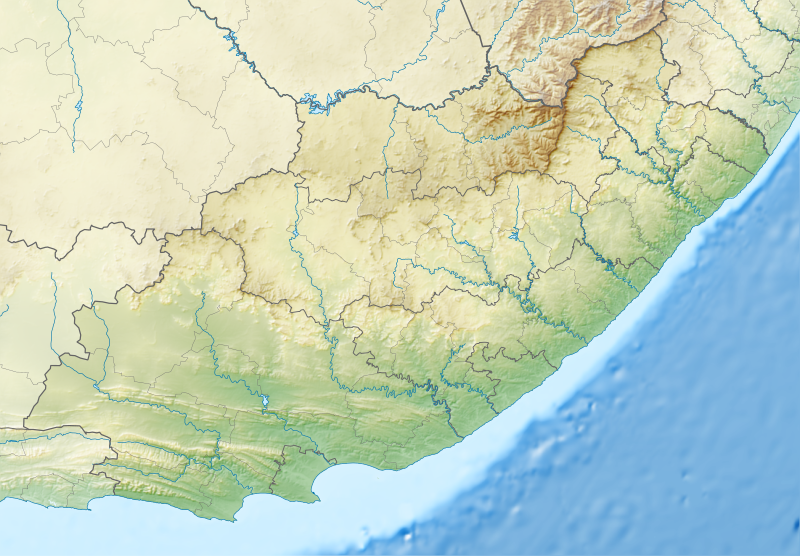
English: Relief location map of the Eastern Cape
Equirectangular projection, N/S stretching 117%. Geographic limits of the map:
|
| Dootem | |
| Kwel |
|
| Skriiwer of Konstler | Htonl |
| Ferloof (Hü det datei brükt woort) |
Ik hual a rochten üüb detdiar werk, an du det frei oner det lisens: Detdiar datei häält en lisens oner det Creative-Commons-lisens „Nööm nääm - Oner salew konditjuunen 3.0. Ei portiaret“.
|
| Ööder wersioonen | File:South Africa Eastern Cape location map.svg |
Datei wersioonen
Klike üüb en tidjponkt, am detdiar wersion uuntulukin.
| Dootem/Tidj | Föörskaubil | Miaten | Brüker | Komentaar | |
|---|---|---|---|---|---|
| aktuel | 00:05, 5. Jan. 2013 | | 1.298 × 902 (2,29 MB) | Htonl | Fix Lesotho masking |
| 23:48, 4. Jan. 2013 |  | 1.298 × 902 (2,29 MB) | Htonl | {{Information |Description ={{en|1=Relief location map of the Eastern Cape Equirectangular projection, N/S stretching 117%. Geographic limits of the map: * N: 29.75° S * S: 34.5° S * W: 22.5° E * E: 30.5° E}} |Source ... |
Hü det datei brükt woort
Jodiar 2 sidjen brük detdiar datei:
Globaal brük faan datein
Jodiar ööder Wikis brük detdiar datei:
- Brük üüb af.wikipedia.org
- Brük üüb ar.wikipedia.org
- Brük üüb ban.wikipedia.org
- Brük üüb bg.wikipedia.org
- Brük üüb bn.wikipedia.org
- Brük üüb ceb.wikipedia.org
- Brük üüb de.wikipedia.org
- Brük üüb en.wikipedia.org
- King Phalo Airport
- Chief Dawid Stuurman International Airport
- MTS Oceanos
- Ben Macdhui (Eastern Cape)
- Mountain Zebra National Park
- Mthatha
- Nahoon River
- South African PGA Championship
- Shamwari Game Reserve
- Port Alfred Airport
- Inkwenkwezi Private Game Reserve
- User:Xhantar/Sandbox2
- Mthatha Airport
- Doddington (East Indiaman)
- Kouga Dam
- Orange–Fish River Tunnel
- South African Masters
- Africa Open
- Great Fish River Nature Reserve
- Baviaanskloof Mega Reserve
- Commando Drift Nature Reserve
- East London Coast Nature Reserve
- Hluleka Nature Reserve
- Mpofu Nature Reserve
Muar globaal brük faan detdiar datei.