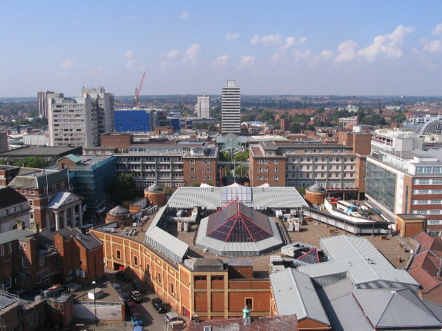
Datei:Broadgate and Precincts - geograph.org.uk - 554599.jpg
Broadgate_and_Precincts_-_geograph.org.uk_-_554599.jpg (640 × 480 pixels, dateigrate: 96 KB, MIME-typ: image/jpeg)
Datei wersioonen
Klike üüb en tidjponkt, am detdiar wersion uuntulukin.
| Dootem/Tidj | Föörskaubil | Miaten | Brüker | Komentaar | |
|---|---|---|---|---|---|
| aktuel | 04:26, 6. Feb. 2011 |  | 640 × 480 (96 KB) | GeographBot | == {{int:filedesc}} == {{Information |description={{en|1=Broadgate and Precincts Taken from the tower of the old cathedral church of St. Michael, looking westwards down the line of the Upper and Lower Precinct shopping areas towards Mercia House[1], the t |
Hü det datei brükt woort
Detdiar sidj brükt detdiar datei:
Globaal brük faan datein
Jodiar ööder Wikis brük detdiar datei:
- Brük üüb af.wikipedia.org
- Brük üüb an.wikipedia.org
- Brük üüb ar.wikipedia.org
- Brük üüb arz.wikipedia.org
- Brük üüb ast.wikipedia.org
- Brük üüb azb.wikipedia.org
- Brük üüb az.wikipedia.org
- Brük üüb be-tarask.wikipedia.org
- Brük üüb be.wikipedia.org
- Brük üüb ca.wikipedia.org
- Brük üüb ceb.wikipedia.org
- Brük üüb cs.wikipedia.org
- Brük üüb cy.wikipedia.org
- Brük üüb da.wikipedia.org
- Brük üüb de.wikipedia.org
- Brük üüb de.wikivoyage.org
- Brük üüb diq.wikipedia.org
- Brük üüb el.wikipedia.org
- Brük üüb en.wikipedia.org
- Brük üüb en.wikivoyage.org
- Brük üüb eo.wikipedia.org
- Brük üüb es.wikipedia.org
- Brük üüb eu.wikipedia.org
- Brük üüb fr.wikipedia.org
- Brük üüb fr.wikivoyage.org
- Brük üüb fy.wikipedia.org
- Brük üüb ga.wikipedia.org
- Brük üüb gl.wikipedia.org
- Brük üüb he.wikivoyage.org
- Brük üüb hy.wikipedia.org
- Brük üüb ku.wikipedia.org
- Brük üüb lld.wikipedia.org
- Brük üüb lv.wikipedia.org
- Brük üüb mdf.wikipedia.org
- Brük üüb mzn.wikipedia.org
- Brük üüb nn.wikipedia.org
- Brük üüb no.wikipedia.org
- Brük üüb os.wikipedia.org
- Brük üüb pl.wikipedia.org
- Brük üüb pl.wikivoyage.org
- Brük üüb pnb.wikipedia.org
- Brük üüb ro.wikipedia.org
- Brük üüb ru.wikinews.org
- Brük üüb sco.wikipedia.org
Muar globaal brük faan detdiar datei.

