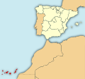
Datei:Localización de la Región de Canarias.svg

Größe der PNG-Vorschau dieser SVG-Datei: 643 × 600 pixel. Ööder apliasangen: 257 × 240 pixel | 515 × 480 pixel | 824 × 768 pixel | 1.098 × 1.024 pixel | 2.196 × 2.048 pixel | 799 × 745 pixel.
Originaal datei (SVG-datei, grate: 799 × 745 pixel, dateigrate: 638 KB)
Datei wersioonen
Klike üüb en tidjponkt, am detdiar wersion uuntulukin.
| Dootem/Tidj | Föörskaubil | Miaten | Brüker | Komentaar | |
|---|---|---|---|---|---|
| aktuel | 09:51, 5. Aug. 2010 |  | 799 × 745 (638 KB) | Orionist | removed border and artifacts, various other fixes |
| 04:26, 18. Feb. 2010 |  | 1.972 × 1.846 (723 KB) | Mircalla22 | {{Information |Description={{en|Map of Spain with the Canary Islands highlighted.}}{{es|Localización de Canarias respecto a España.}} }} |Source=*File:Localización_de_la_Región_de_Murcia.svg *[[:File:The |
Hü det datei brükt woort
Detdiar sidj brükt detdiar datei:
Globaal brük faan datein
Jodiar ööder Wikis brük detdiar datei:
- Brük üüb als.wikipedia.org
- Brük üüb am.wikipedia.org
- Brük üüb ast.wiktionary.org
- Brük üüb ba.wikipedia.org
- Brük üüb be-tarask.wikipedia.org
- Brük üüb ca.wikipedia.org
- Brük üüb cs.wikipedia.org
- Brük üüb de.wikipedia.org
- Brük üüb el.wikipedia.org
- Brük üüb el.wiktionary.org
- Brük üüb en.wikipedia.org
- Brük üüb eo.wikipedia.org
- Brük üüb es.wikipedia.org
- Brük üüb fo.wikipedia.org
- Brük üüb fr.wikipedia.org
- Brük üüb fr.wikinews.org
- Brük üüb gcr.wikipedia.org
- Brük üüb he.wikivoyage.org
- Brük üüb hy.wikipedia.org
- Brük üüb ia.wikipedia.org
- Brük üüb it.wikipedia.org
- Brük üüb ky.wikipedia.org
- Brük üüb lad.wikipedia.org
- Brük üüb lij.wikipedia.org
- Brük üüb lt.wikipedia.org
- Brük üüb lv.wikipedia.org
- Brük üüb mi.wikipedia.org
- Brük üüb mn.wikipedia.org
- Brük üüb mrj.wikipedia.org
- Brük üüb mr.wikipedia.org
- Brük üüb nap.wikipedia.org
- Brük üüb nl.wikipedia.org
- Brük üüb pl.wiktionary.org
Muar globaal brük faan detdiar datei.
