Datei:Map of the Free State with districts labelled (2011).svg

Größe der PNG-Vorschau dieser SVG-Datei: 716 × 599 pixel. Ööder apliasangen: 287 × 240 pixel | 574 × 480 pixel | 918 × 768 pixel | 1.224 × 1.024 pixel | 2.447 × 2.048 pixel | 828 × 693 pixel.
Originaal datei (SVG-datei, grate: 828 × 693 pixel, dateigrate: 503 KB)
.svg)
Beskriiwang
| Beskriiwang |
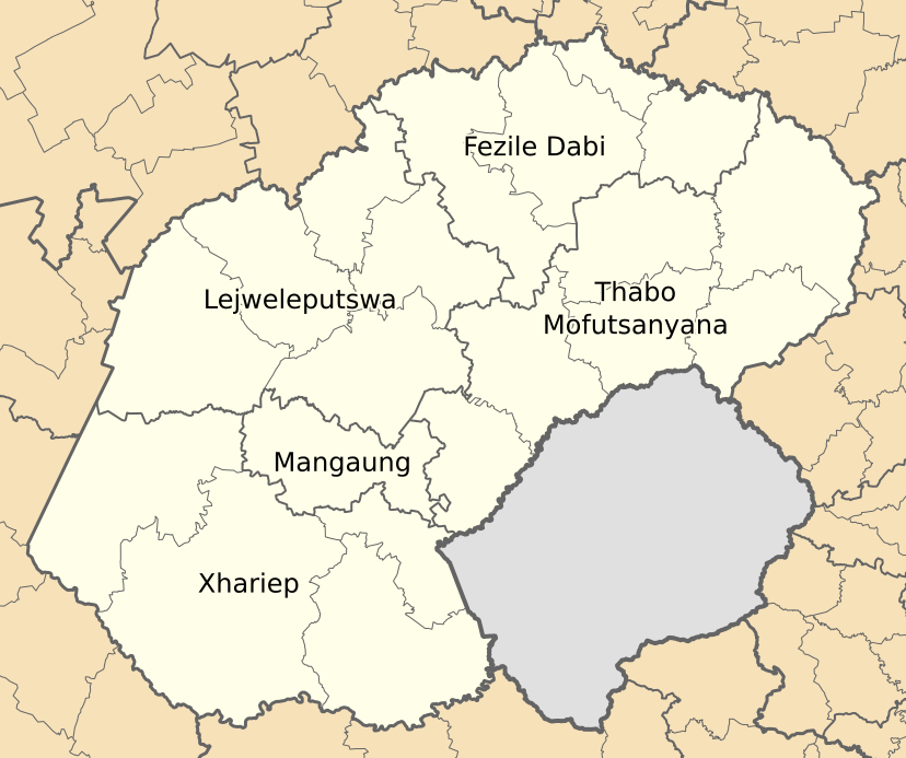
English: Map of municipal boundaries in the Free State, as they will be after the municipal elections of 18 May 2011, with district and metropolitan municipalities named. |
| Dootem | |
| Kwel | Aanj werk |
| Skriiwer of Konstler | Htonl |
Lisens
Ik hual a rochten üüb detdiar werk, an du det frei oner a lisensen:

|
Dü könst det datei kopiare, widjerdu of feranre efter a reegeln faan't GNU Free Documentation License, wersion 1.2 of leeder faan't Free Software Foundation; diar as niks ünferanerlik an nään tekst üüb a föör- of bääftsidj. Dü könst di lisens tekst efterlees bi GNU Free Documentation License. |
This file is licensed under the Creative Commons Attribution-Share Alike 4.0 International, 3.0 Unported, 2.5 Generic, 2.0 Generic and 1.0 Generic license.
- Dü mutst detdiar werk
- widjer du – detdiar werk kopiare an widjer du
- nei tuupstel – det werk feranre
- Oner jodiar konditjuunen:
- Nööm nääm – Dü skel di nööm faan di skriiwer of konstler nääm. Oober ei so, dat at so ütjsjocht, üs wan hi din werk gud fanjt.
- Oner josalew konditjuunen widjerdu – Wan dü detdiar werk feranerst, skel dü det resultaat oner detsalew lisens widjer du.
Schük di ian faan jodiar lisensen ütj.
Datei wersioonen
Klike üüb en tidjponkt, am detdiar wersion uuntulukin.
| Dootem/Tidj | Föörskaubil | Miaten | Brüker | Komentaar | |
|---|---|---|---|---|---|
| aktuel | 02:04, 14. Mei 2011 | | 828 × 693 (503 KB) | Htonl | svg code tweak |
| 01:52, 14. Mei 2011 |  | 828 × 693 (503 KB) | Htonl | redo labels | |
| 21:08, 2. Mei 2011 |  | 828 × 693 (532 KB) | Htonl | spelling | |
| 20:56, 2. Mei 2011 |  | 828 × 693 (532 KB) | Htonl | == Summary == {{Information |Description ={{en|1=Map of municipal boundaries in the w:Free State, as they will be after the municipal elections of 18 May 2011, with district and metropolitan municipalit |
Hü det datei brükt woort
Detdiar sidj brükt detdiar datei:
Globaal brük faan datein
Jodiar ööder Wikis brük detdiar datei:
- Brük üüb en.wikipedia.org
- Brük üüb hu.wikipedia.org
- Brük üüb hy.wikipedia.org
- Brük üüb ml.wikipedia.org
- Brük üüb nso.wikipedia.org
- Brük üüb pl.wikipedia.org
.svg)