Datei:TorresStraitIslandsMap.png

Grate faan detdiar föörskaubil: 604 × 599 pixel. Ööder apliasangen: 242 × 240 pixel | 484 × 480 pixel | 929 × 922 pixel.
Originaal datei (929 × 922 pixels, dateigrate: 28 KB, MIME-typ: image/png)
Beskriiwang

|
Dieses Bild des Typs Locator map sollte als Vektorgrafik im SVG-Format neu erstellt werden. Vektorformate haben zahlreiche Vorteile; weitere Information unter Commons:Media for cleanup. Wenn dir eine SVG-Version dieses Bildes vorliegt, so lade diese bitte hoch. Nach dem Hochladen der Datei ist diese Vorlage auf der aktuellen Bildbeschreibungsseite durch die Vorlage {{Vector version available}}, oder kürzer {{Vva}}, zu ersetzen. Es ist empfohlen die neue SVG-Datei „TorresStraitIslandsMap.svg“ zu nennen – dann benötigt die Vorlage vector version available (bzw. vva) keinen Parameter.
|
| Beskriiwang |
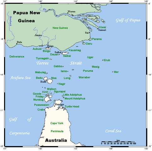
A map of the Torres Strait Islands. I have endeavoured to use native names wherever I could find them. If you can suggest ways in which this map could be made more up to date, don't hesitate to leave me a message to that effect. This map's source is here, with the uploader's modifications, and the GMT homepage says that the tools are released under the GNU General Public License. |
| Dootem | 18. April 2006 (Original-Hochladedatum) |
| Kwel | Übertragen aus en.wikipedia nach Commons. |
| Skriiwer of Konstler | Kelisi in der Wikipedia auf Ingelsk |
| Ööder wersioonen | Image:TorresStraitIslandsMap (zh).png |
.png)
Lisens
Kelisi aus der englischsprachigen Wikipedia häält a rochten üüb detdiar werk an dää det frei oner det lisens:
| Detdiar datei häält en lisens oner det Creative-Commons-lisens „Nööm nääm - Oner salew konditjuunen 3.0. Ei portiaret“. Vorbehaltlich der Haftungsausschlüsse. | ||
| nööm nääm: Kelisi aus der englischsprachigen Wikipedia | ||
| ||
| Detdiar lisenstiaken kaam mä't GFDL lisens update. |

|
Dü könst det datei kopiare, widjerdu of feranre efter a reegeln faan't GNU Free Documentation License, wersion 1.2 of leeder faan't Free Software Foundation; diar as niks ünferanerlik an nään tekst üüb a föör- of bääftsidj. Dü könst di lisens tekst efterlees bi GNU Free Documentation License. Vorbehaltlich der Haftungsausschlüsse. |
Originaal datei-logbuk
Die ursprüngliche Dateibeschreibungsseite war hier. Alle folgenden Benutzernamen beziehen sich auf en.wikipedia.
- 2006-04-19 00:55 Kelisi 929×922×8 (28510 bytes)
- 2006-04-18 03:38 Kelisi 929×922×8 (28133 bytes) A map of the Torres Strait Islands. I have endeavoured to use native names wherever I could find them. If you can suggest ways in which this map could be made more up to date, don't hesitate to leave me a message to that effect. This map's source is [htt
Datei wersioonen
Klike üüb en tidjponkt, am detdiar wersion uuntulukin.
| Dootem/Tidj | Föörskaubil | Miaten | Brüker | Komentaar | |
|---|---|---|---|---|---|
| aktuel | 08:42, 13. Jan. 2022 | | 929 × 922 (28 KB) | Kelisi | Reverted to version as of 00:09, 1 May 2007 (UTC) Hardly; those two colours are closer to each other. |
| 19:59, 6. Okt. 2021 |  | 929 × 922 (31 KB) | Claude Zygiel | Better contrast | |
| 02:09, 1. Mei 2007 |  | 929 × 922 (28 KB) | Stanmar | {{Information |Description=A map of the Torres Strait Islands. I have endeavoured to use native names wherever I could find them. If you can suggest ways in which this map could be made more up to date, don't hesitate to leave me a message to that effect. |
Hü det datei brükt woort
Jodiar 2 sidjen brük detdiar datei:
Globaal brük faan datein
Jodiar ööder Wikis brük detdiar datei:
- Brük üüb af.wikipedia.org
- Brük üüb als.wikipedia.org
- Brük üüb ar.wikipedia.org
- Brük üüb azb.wikipedia.org
- Brük üüb ba.wikipedia.org
- Brük üüb bg.wikipedia.org
- Brük üüb bn.wikipedia.org
- Brük üüb br.wikipedia.org
- Brük üüb ca.wikipedia.org
- Brük üüb ceb.wikipedia.org
- Brük üüb cs.wikipedia.org
- Brük üüb cy.wikipedia.org
- Brük üüb da.wikipedia.org
- Brük üüb de.wikipedia.org
- Torres-Straße
- Prince-of-Wales-Insel (Queensland)
- Torres-Straits-Expedition
- Bellevue-Inseln
- Mabuiag
- Talbot-Inseln
- Boigu
- Flagge der Torres-Strait-Insulaner
- Manar-Inseln
- Thursday Island
- Horn Island (Torres Strait)
- Saibai
- Thursday-Inseln
- The Three Sisters (Torres Strait)
- Dauan
- Bet Island
- Poll Island
- Sue Island
- Murray-Inseln
- Murray Island
- Badu Island
- Moa Island
- Coconut Island (Australien)
- Yam Island
- Hammond Island
- Goods Island
- Friday Island (Torres Strait)
Muar globaal brük faan detdiar datei.