Datei:Eure department location map.svg

Größe der PNG-Vorschau dieser SVG-Datei: 699 × 600 pixel. Ööder apliasangen: 280 × 240 pixel | 559 × 480 pixel | 895 × 768 pixel | 1.193 × 1.024 pixel | 2.386 × 2.048 pixel | 1.165 × 1.000 pixel.
Originaal datei (SVG-datei, grate: 1.165 × 1.000 pixel, dateigrate: 431 KB)
Beskriiwang
| Kameraposition | | Dieses und weitere Bilder auf OpenStreetMap |
|---|
| Beskriiwang |
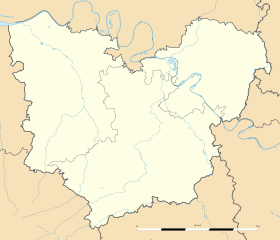
Français : Carte administrative vierge du département de l'Eure, France, destinée à la géolocalisation. Estimated scale: 1:400,000 (precision: 100 m)
Geographic limits of the map:
|
||
| Dootem | |||
| Kwel |
Aanj werk
|
||
| Skriiwer of Konstler | Eric Gaba (Sting - fr:Sting) | ||
| Ferloof (Hü det datei brükt woort) |
|
||
| Ööder wersioonen |
|

Lisens
Eric Gaba, Wikimedia Commons user Sting häält a rochten üüb detdiar werk an dää det frei oner det lisens:
Detdiar datei häält en lisens oner det Creative-Commons-lisens „Nööm nääm - Oner salew konditjuunen 3.0. Ei portiaret“.
nööm nääm: Eric Gaba, Wikimedia Commons user Sting
- Dü mutst detdiar werk
- widjer du – detdiar werk kopiare an widjer du
- nei tuupstel – det werk feranre
- Oner jodiar konditjuunen:
- Nööm nääm – Dü skel di nööm faan di skriiwer of konstler nääm. Oober ei so, dat at so ütjsjocht, üs wan hi din werk gud fanjt.
- Oner josalew konditjuunen widjerdu – Wan dü detdiar werk feranerst, skel dü det resultaat oner detsalew lisens widjer du.
Datei wersioonen
Klike üüb en tidjponkt, am detdiar wersion uuntulukin.
| Dootem/Tidj | Föörskaubil | Miaten | Brüker | Komentaar | |
|---|---|---|---|---|---|
| aktuel | 03:38, 12. Mar. 2010 | | 1.165 × 1.000 (431 KB) | Sting | == {{int:filedesc}} == {{Location|49|04|30|N|01|03|00|E|scale:500000}} <br/> {{Information |Description={{en|Blank administrative map of the department of Eure, France, for geo-location purpose.}} |
Hü det datei brükt woort
Jodiar 3 sidjen brük detdiar datei:
Globaal brük faan datein
Jodiar ööder Wikis brük detdiar datei:
- Brük üüb als.wikipedia.org
- Brük üüb de.wikipedia.org
- Brük üüb eo.wikipedia.org
- Gisors
- Ŝablono:Situo sur mapo Francio Eure
- Les Andelys
- Bernay (Eure)
- Conches-en-Ouche
- Giverny
- Évreux-Normandie (stacidomo)
- Verneuil-sur-Avre
- Bernay (stacidomo)
- Serquigny (stacidomo)
- Val-de-Reuil (stacidomo)
- Beaumont-le-Roger
- Pont-Audemer
- Verneuil-sur-Avre (stacidomo)
- Brionne (stacidomo)
- Bourgtheroulde-Infreville
- Thuit-Hébert
- Bueil (stacidomo)
- Glos - Montfort (stacidomo)
- Bourgtheroulde - Thuit-Hébert (stacidomo)
- Bourth
- Bourth (stacidomo)
- Nonancourt
- Tillières-sur-Avre
- Saint-Germain-sur-Avre
- Tillières (stacidomo)
- Nonancourt (stacidomo)
- Saint-Germain - Saint-Rémy (stacidomo)
- Acquigny
- Aigleville
- Amfreville-sur-Iton
- Angerville-la-Campagne
- Arnières-sur-Iton
- Aviron (Eure)
- Les Baux-Sainte-Croix
- Boisset-les-Prévanches
- La Boissière (Eure)
- Le Boulay-Morin
- Breuilpont
- Caillouet-Orgeville
- Caugé
- Chaignes
- Chambray
- Louviers
- Boncourt (Eure)
- La Chapelle-du-Bois-des-Faulx
Muar globaal brük faan detdiar datei.