Datei:Map of Montana highlighting Glacier County.svg

Größe der PNG-Vorschau dieser SVG-Datei: 800 × 461 pixel. Ööder apliasangen: 320 × 185 pixel | 640 × 369 pixel | 1.024 × 591 pixel | 1.280 × 738 pixel | 2.560 × 1.477 pixel | 9.194 × 5.303 pixel.
Originaal datei (SVG-datei, grate: 9.194 × 5.303 pixel, dateigrate: 122 KB)
Beskriiwang
| Beskriiwang |
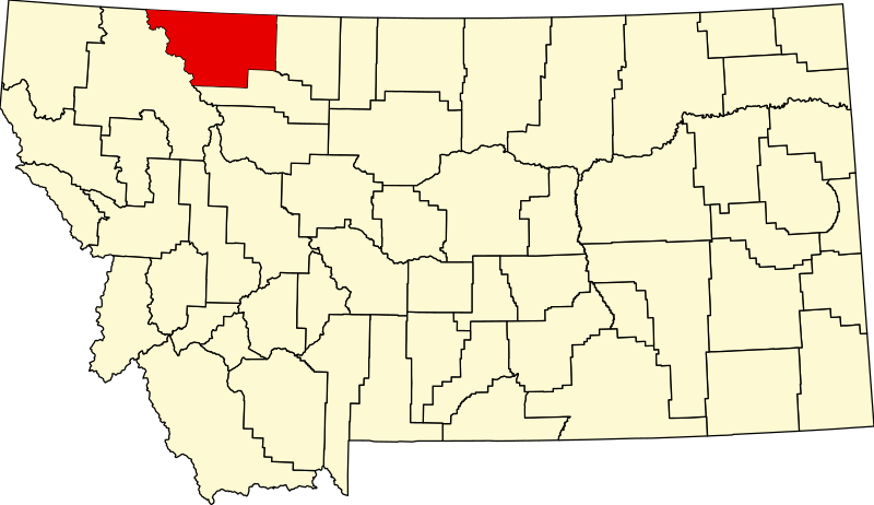
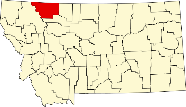
English: This is a locator map showing Glacier County in Montana. For more information, see Commons:United States county locator maps. |
| Dootem | |
| Kwel |
Aanj werk: English: The maps use data from nationalatlas.gov, specifically countyp020.tar.gz on the Raw Data Download page. The maps also use state outline data from statesp020.tar.gz. The Florida maps use hydrogm020.tar.gz to display Lake Okeechobee. |
| Skriiwer of Konstler | David Benbennick |
Lisens
| Ik haa a rochten üüb detdiar datei an du det frei üs public domain (för arken frei). Det täält uun arke lun. Uun enkelt lunen mei det ei mögelk wees. Wan det so as: Arken koon detdiar werk brük för wat hi wal, wan det uun sin lun rochtelk mögelk as. |
Datei wersioonen
Klike üüb en tidjponkt, am detdiar wersion uuntulukin.
| Dootem/Tidj | Föörskaubil | Miaten | Brüker | Komentaar | |
|---|---|---|---|---|---|
| aktuel | 15:29, 12. Feb. 2006 | | 9.194 × 5.303 (122 KB) | David Benbennick | {{subst:User:Dbenbenn/clm|county=Glacier County|state=Montana|type=county}} |
Hü det datei brükt woort
Detdiar sidj brükt detdiar datei:
Globaal brük faan datein
Jodiar ööder Wikis brük detdiar datei:
- Brük üüb ar.wikipedia.org
- Brük üüb bg.wikipedia.org
- Brük üüb bpy.wikipedia.org
- Brük üüb cdo.wikipedia.org
- Brük üüb ceb.wikipedia.org
- Brük üüb cy.wikipedia.org
- Brük üüb de.wikipedia.org
- Brük üüb en.wikipedia.org
- List of counties in Montana
- Glacier County, Montana
- Browning, Montana
- Cut Bank, Montana
- East Glacier Park Village, Montana
- North Browning, Montana
- South Browning, Montana
- Starr School, Montana
- Going-to-the-Sun Road
- Two Medicine Store
- St. Mary, Montana
- Rising Sun Auto Camp
- Babb, Montana
- Great Northern Railway Buildings
- Camp Disappointment
- User:Nyttend/County templates/MT
- Template:Glacier County, Montana
- Ptarmigan Tunnel
- East Glacier Ranger Station Historic District
- Two Medicine Campground Camptender's Cabin
- Cut Bank Ranger Station Historic District
- Roes Creek Campground Camptender's Cabin
- Many Glacier Campground Camptender's Cabin
- Goathaunt Bunkhouse
- Logan Pass Visitor Center
- Saint Mary Visitor Center, Entrance Station and Checking Stations
- Lee Creek Snowshoe Cabin
- Many Glacier Barn and Bunkhouse
- Kootenai Creek Snowshoe Cabin
- Swiftcurrent Auto Camp Historic District
- Swanson Boathouse
Muar globaal brük faan detdiar datei.