Iowa
| Iowa | |
|---|---|
 (Iowas foone) |
 (Iowas säägel) |
| Uukelnoome: | The Hawkeye State, The Tall Corn State |
| Oufkorting: | IA |

| |
| Hoodstää | |
| Grutste stää | |
| Guvernöör | |
| Gebiit - totool |
Nr. 26 145.743 km² |
| Beföljking - totool |
Nr. 30 2.988.046 (2007) |
| Beföljkingstachthäid - totool |
20,65 inb./km² |
| Tuträäs önj e union - nr. |
|
| Tidssoone | Central: UTC -6/-5 |
| Briidjgrood | 40°36'N bit 43°30'N |
| Laingdegrood | 89°5'W bit 96°31'W |
| Briidj Laingde |
320 km 500 km |
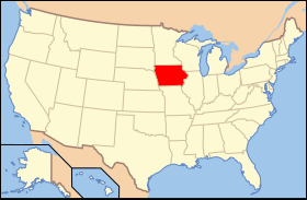
Iowa [ˈaɪəwə] as sunt 1846 en diiljstoot foon da Feriind Stoote. E diiljstoot läit önj e mal foon't lönj. Dåt heet 3.155.070 manschne (2019)[1]. E hoodstää foon e diiljstoot as Des Moines.
Geografii
BewerkeDe Mississippi Struum as för't miast at uastgrens faan a bundesstoot.
Stääse
BewerkeDa tiin grutst stääse önj e diiljstoot san:
| # | Stää | Manschne (2019)[2] | Koord | |
|---|---|---|---|---|
| 1 | Des Moines | 214.237 | ||
| 2 | Cedar Rapids | 133.562 | ||
| 3 | Davenport | 101.590 | ||
| 4 | Sioux City | 82.651 | ||
| 5 | Iowa City | 75.130 | ||
| 6 | West Des Moines | 67.899 | ||
| 7 | Ankeny | 67.355 | ||
| 8 | Waterloo | 67.328 | ||
| 9 | Ames | 66.258 | ||
| 10 | Council Bluffs | 62.166 |
Counties
BewerkeIowa heet 99 counties:
Kiik uk deer: List ma counties önj Iowa
Kwäle
Bewerke42-93
Koordinaaten: 42° N, 93° W